A Surround Sound civic tool
The Civic Map
Explore every U.S. civic boundary: states, counties, cities, school and electoral districts, with the demographics and representatives that shape local communities.
Pick a lens
Pick what kind of boundary you're exploring. The zoom does the rest: the map moves from states to counties to cities automatically, so you never pick a level by hand.
States → cities
Start at the state and zoom down to the street: states, counties, county subdivisions, and cities/places, each with a full demographic snapshot.
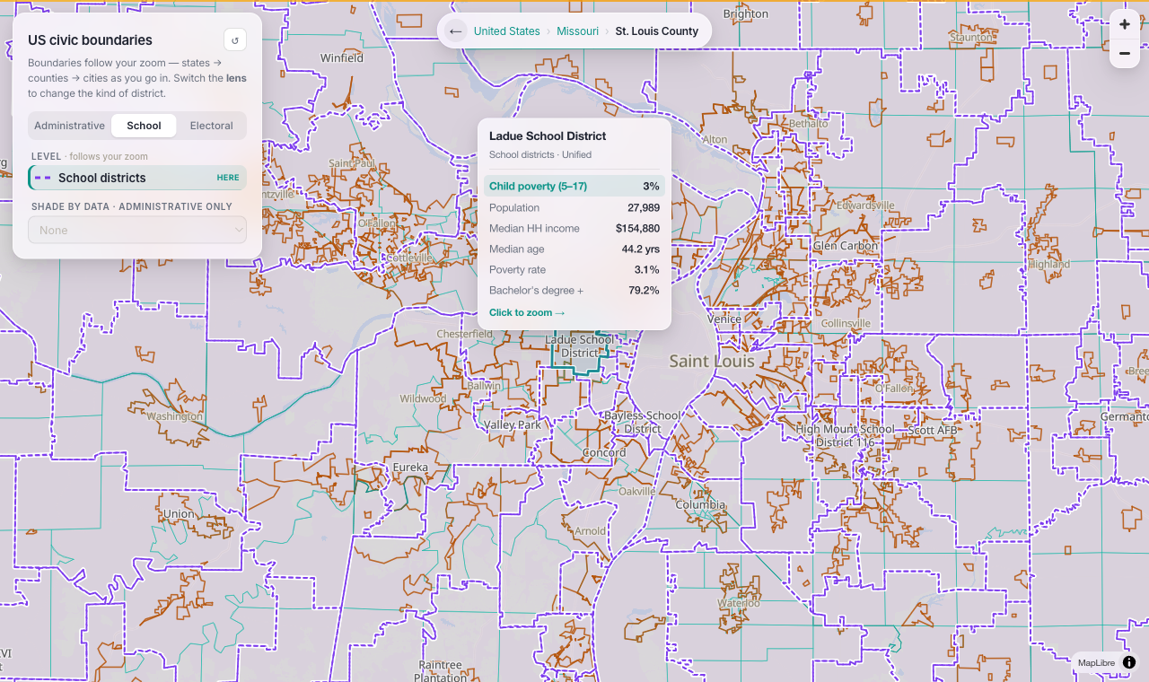
School districts
Every unified and elementary district in one layer, with enrollment-area demographics and Title I child-poverty rates.
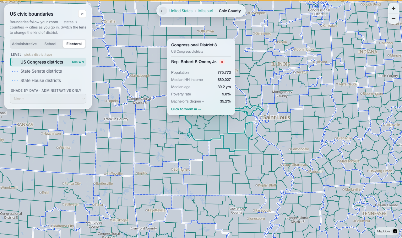
Districts + reps
Congressional and state-legislative districts. Congressional ones show the current U.S. House member and party.
Built for the newsroom
A snapshot for any place in seconds, plus a shareable, embeddable view for readers.
Demographics on hover
Hover any region for a "who lives here" card: population, median income, median age, poverty and education. For a district it adds the House member; for a school, child poverty.
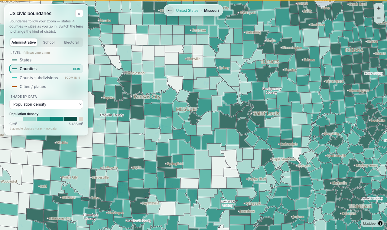
Shade by income, poverty, or density
Turn any boundary level into a choropleth — population density, income, poverty, education — classed into quantiles so skewed data still shows variation instead of washing out.
School districts & child poverty
Find the district around any community and read its Title I child-poverty rate and demographics — the core numbers behind local education coverage.
The data, and where it comes from
Everything on the map is built from open, public-domain or openly-licensed government data. No proprietary sources, free to use and share.
| Dataset | What it provides | Source | License |
|---|---|---|---|
| Cartographic Boundary Files | All civic boundaries (states → school & electoral districts) | U.S. Census Bureau (2023) | Public domain |
| American Community Survey | Population, income, age, poverty, education by region | U.S. Census Bureau (ACS 5-yr 2023) | Public domain |
| SAIPE | School-district child-poverty estimates | U.S. Census Bureau (2022) | Public domain |
| congress-legislators | Current U.S. House members & party | @unitedstates project | CC0 |
| Basemap | Land, water, roads, place labels | OpenStreetMap via Protomaps | ODbL |
Find your community
Zoom into any town and see its boundaries, its representatives, and the data behind the headlines.
Open the map →